Import and export
Export all your data (a complete Excel workbook, GIS files, plot photos, and files for USFS planning software) and bring data in: spreadsheets from other cruises, georeferenced maps and topo quads.
9.1The Import/Export screen
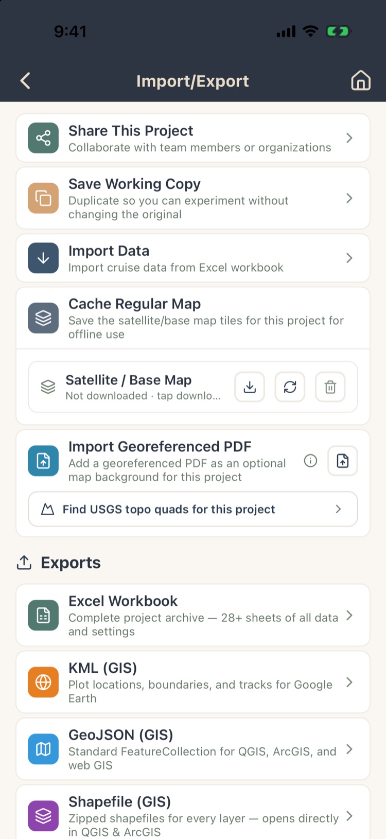
Tap Import/Export on Project Home’s bottom bar. Everything here applies to the open project.
- Share This Project: give teammates or your organization access (Chapter 12).
- Save Working Copy: a separate copy to experiment with (Chapter 2, section 2.4).
- Import Data Pro: bring in stands, plots and trees from Excel (section 9.5).
- Cache Regular Map Pro: download, refresh or clear this project’s offline map (Chapter 7, section 7.7).
- Import Georeferenced PDF Max and Find USGS topo quads (section 9.6).
- Exports, Maps and USFS Software Exports (sections 9.2 to 9.4).
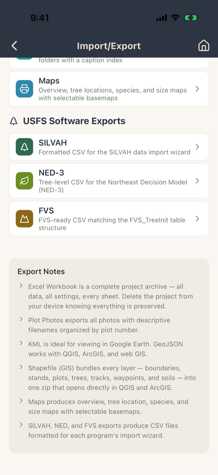
Export Notes at the bottom summarize what each format holds.
9.2Exporting project data
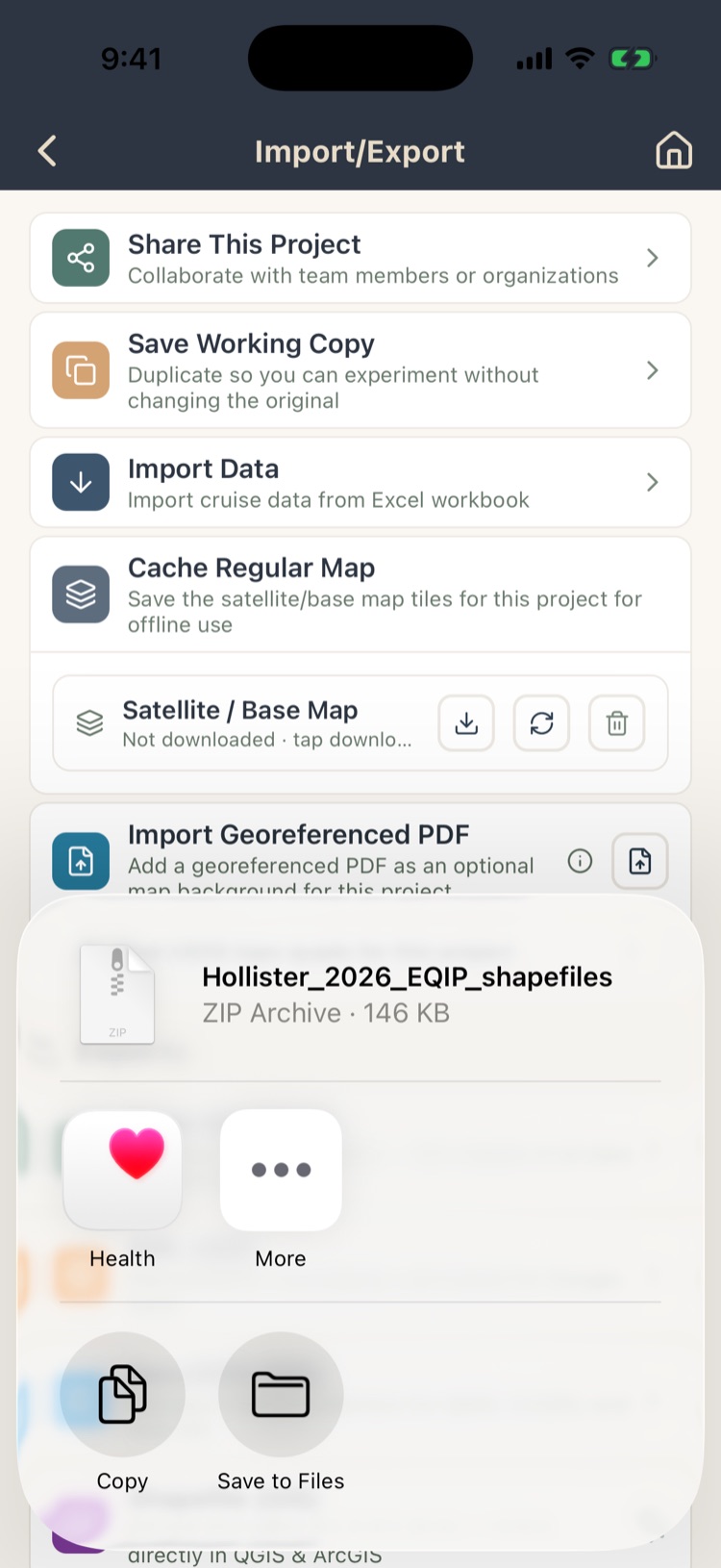
Tap an export. The app builds the file and opens the share sheet: save it to Files, AirDrop it to your computer, email it, or send it to Google Drive or Dropbox.
| Export | What you get |
|---|---|
| Excel Workbook | The complete project archive: every stand, plot, tree, observation and setting, on 28 or more sheets. Keep one when you finish a project. It can be imported again (section 9.5). |
| KML (GIS) Pro | Plot locations, boundaries and tracks for Google Earth. |
| GeoJSON (GIS) Max | A standard feature collection for QGIS, ArcGIS and web maps. |
| Shapefile (GIS) Max | A zip of shapefiles, one per layer (boundary, stands, plots, trees, tracks, waypoints and soils), that opens directly in QGIS and ArcGIS. |
| Plot Photos | Every plot photo in a zip, in folders by plot number, with an index of captions. |
If a project has no photos or no GPS locations, the app says so instead of making an empty file.
9.3USFS software exports Pro
Three exports produce CSV files formatted for USDA Forest Service planning programs. Each matches that program’s own import format:
- SILVAH: for the SILVAH data import wizard (Allegheny and northern hardwood prescriptions).
- NED-3: a tree-level CSV for the Northeast Decision Model.
- FVS: matching the Forest Vegetation Simulator’s FVS_TreeInit table, for growth projections.
They need tree data; a project without trees shows a warning.
9.4Shareable maps Pro
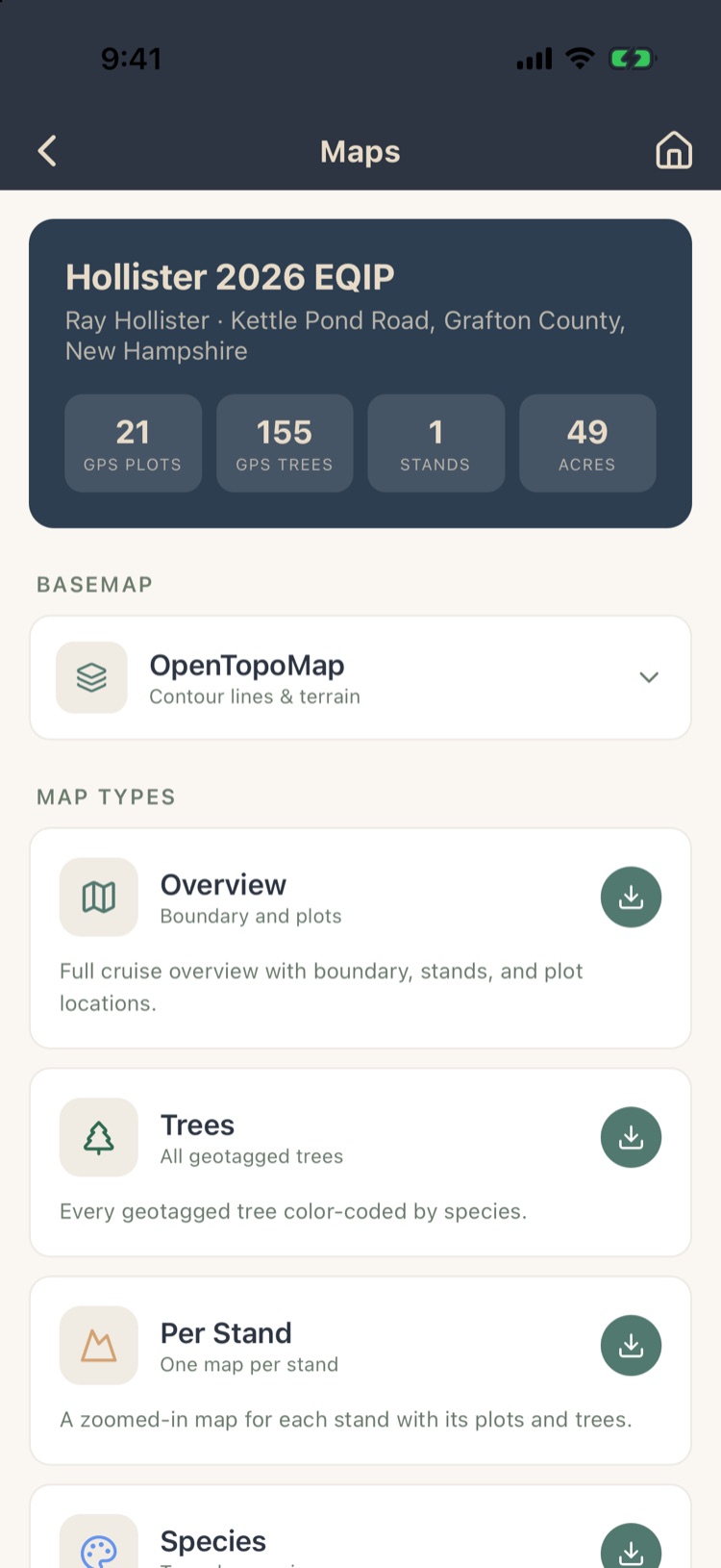
Maps makes interactive map pages you can send to a landowner or colleague. They open in any web browser, no app needed. The top shows what can be mapped: plots and trees with GPS, stands and acres.
- Basemap: satellite, outdoors, streets, OpenStreetMap, OpenTopoMap, USGS Topo and others.
- Map types: Overview (boundary, stands and plots), Trees (every tree with a location, colored by species), Per Stand (a zoomed map of each stand), Species and Size.
Tap the download button on a map type to export it, or Export All Maps. Tree maps need trees with GPS locations (Chapter 5).
9.5Importing from Excel Pro
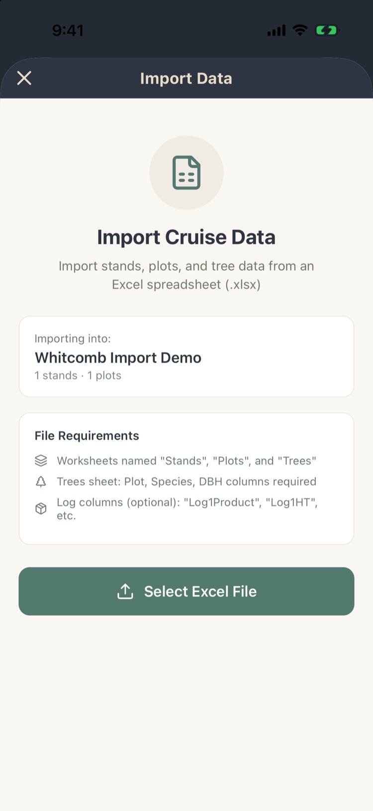
Open the project to import into, then Import/Export › Import Data. It brings stands, plots and trees from an Excel workbook into that project: an older cruise, data from another program, or a Forest Metrix workbook.
File requirements: worksheets named Stands, Plots and Trees. The Trees sheet needs Plot, Species and DBH columns; log columns (such as Log1Product, Log1HT) are optional.
- Tap Select Excel File and choose the .xlsx file.
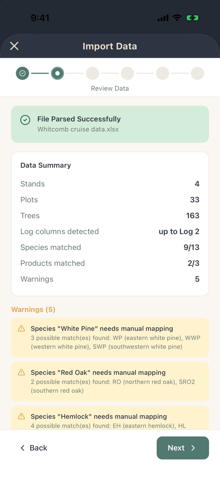
- The app reads it and summarizes what it found, or explains what went wrong.
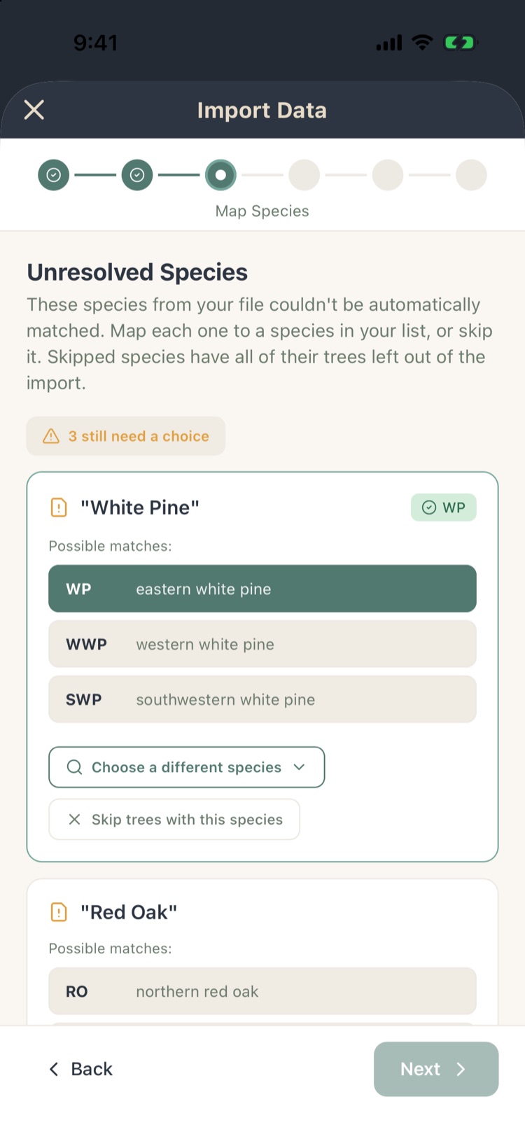
- Species: match any species it doesn’t recognize to your species list. It suggests likely matches; you can search for others.
- Products: match each unrecognized product to one of yours, add it as a new product, or skip it (its logs are then left out). Next waits until every product has a choice.
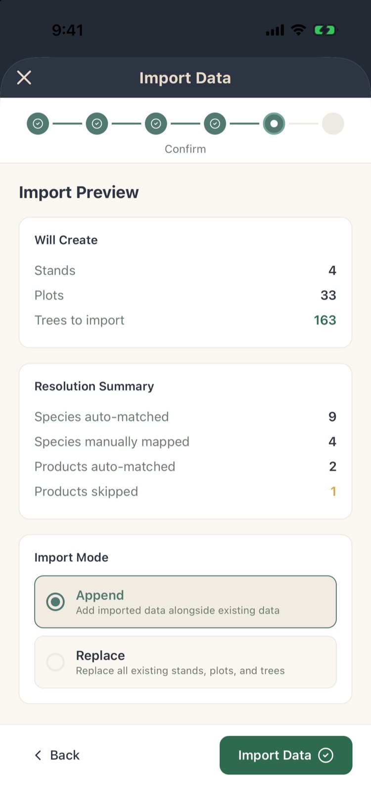
- Preview: what will be created and skipped. Choose Append to add to the project or Replace to replace its data.
- Tap Import Data. The app reports what it imported, with a log.
Replace deletes the project’s existing stands, plots and trees before importing. Make a working copy first if you’re unsure.
A new project starts with an empty Stand 1 and Plot 1. Append works: an empty plot whose number the file uses is dropped in favor of the imported one.
9.6Importing maps Max
Georeferenced PDF
Tap Import Georeferenced PDF and choose a PDF up to 100 MB that carries its own map coordinates (a GeoPDF), such as a management-plan map exported from ArcGIS or QGIS. The app turns it into map tiles stored on the phone. If the PDF has no coordinates, or is too large, the app tells you.
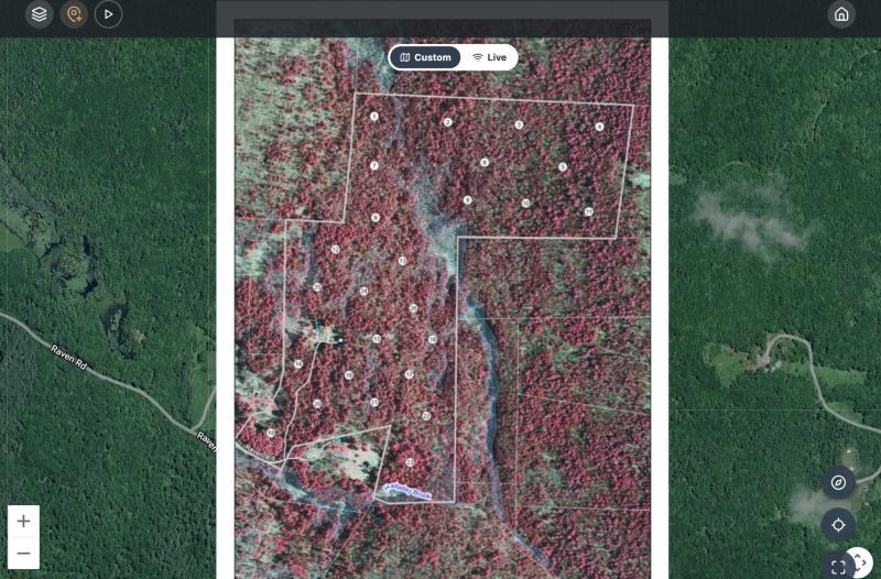
The PDF is processed on the server, which takes a minute or so; its row reads processing until it’s ready. Once imported, choose Custom above the project map to use it (Chapter 7, section 7.8). The PDF’s row here lets you refresh it, download it for offline use, or remove it.
USGS topo quads
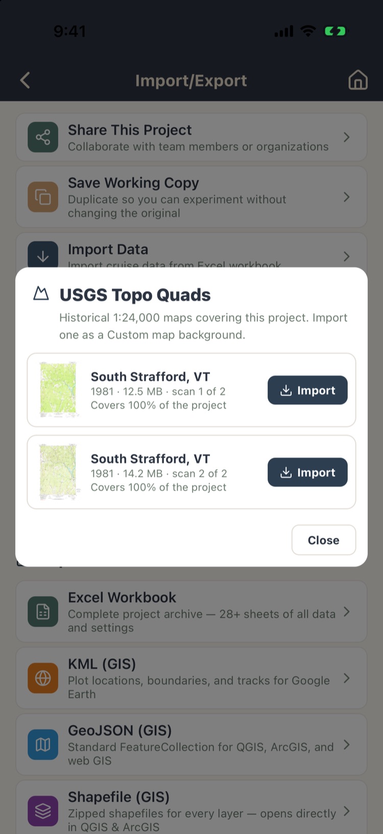
Find USGS topo quads for this project lists the historical USGS 1:24,000 quads that cover the property, with the year, the scan and how much of the project each covers. Tap Import to add one as a custom map.
9.7Other imports
- Boundaries and stands from KML or GeoJSON: Chapter 3, sections 3.2 and 3.8.
- Plot locations from KML: Chapter 4, section 4.6.
- Templates: export a template to a file and import it on another account (Chapter 10).
- Custom reports: Import Report in Custom Reports brings in a report someone shared (Chapter 8, section 8.10).